IRELAND -THE BURREN, PART 3

Continuing from the previous chapters (a week-long vacation in Ireland's County Clare and the Burren region: THE BURREN - PART 1. and THE BURREN - 2. PART) - the plan for the 3rd day was as follows: Cliffs of Moher - Loop Head lighthouse - Bridges of Ross.

Cliffs of Moher: We first got to see the Cliffs of Moher from the ocean side. On the advice of the ferry company's customer service, we bought the tickets online the day before. The 50-minute trip costs 28 EUR per person (June 2025). There is parking available at the port, but I think it is not sufficient during the season, as we saw a less developed parking area a bit further away. It is recommended to arrive half an hour before departure. The ticket validation is done using the QR code received in the confirmation. The boat is double-decker, with open and covered sections. We were a bit unsure about which side to sit on, but as we later experienced, it's unnecessary to deliberate over this. On the way there, one side can enjoy the view of the rocky cliffs, and on the way back, the other side can admire it too.
The ferry is equipped with a motion stabilisation mechanism, which is a blessing for those sensitive to the waves. Of course, people who are experienced sailors know that there is a wind strength when no stabiliser can help, but I'll write about that later.

The 50-minute program includes a brief introduction in English, but of course, that's not the reason to sign up for this trip.
The ancient Gaelic "Mhothair" (meaning: ruined fort) cliffs reach heights of up to 214 meters in places - the ferry passes directly beneath this point - and they rise almost vertically above the ocean. The best view of the sheer height is from the sea, where walkers on the cliff top look like ants. The furthest point from Doolin is Hags Head, in Liscannor; here is the 1st-century fort, the Moher Tower.


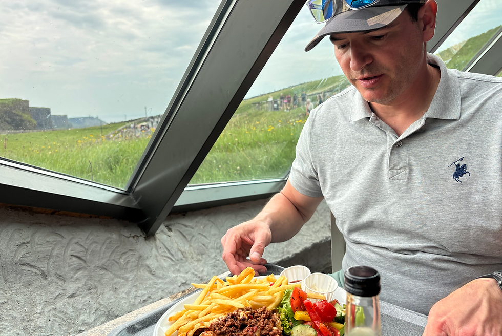
After the ferry ride, we got into the car and drove to the parking lot of the Cliffs of Moher Visitor Center. From here, a few hundred meters away, is the center itself, where exhibitions, souvenir shops, and a restaurant await tourists. The building is not extravagant; it discreetly blends into the landscape. The restaurant offers excellent value for money; it is characterised by large, simple but tasty portions and quick service. If you manage to sit by the window, you can also enjoy the view.
The Cliffs of Moher are composed of Namurian shale and sandstone layers, shaped by wind and weather over millions of years. The oldest rocks are at the bottom of the cliff, and there is also a 300 million-year-old riverbed between the rocks. The erosion caused by foot traffic has worn away the tops of the paths in many places, while the cliffs are being eroded from below by wind and water. This phenomenon has reached a level where some sections of the footpath are no longer safe, so a significant portion of the path has been closed off. :-(

People have inhabited this region for millennia and several Neolithic sites found throughout County Clare. However, tourism here only began in the 18th century when Sir Cornelius O'Brien, the landowner, had the O'Brien Tower built.


The building was designed as an observation tower and tea house for the contemporary Victorian English visitors who flocked to this "wild" countryside. In clear weather, it can be seen all the way from the southern part of County Clare to Connemara and the Aran Islands.

On the southern side, near the village of Liscannor, is the Moher Tower at Hag's Head. It was built in 1808 on top of a previous fortress with the intention of protecting Ireland from a potential French invasion. Hag's Head got its name from a witch. Beara, the witch, becomes younger and stronger throughout the winter, but in the summer, her strength wanes and she grows old again. According to the legend, if the weather is bad on February 1st (St. Brigid's Day, the first day of spring according to the Gaelic calendar), it means that Beara is asleep and winter will soon come to an end. However, if it is clear, then she is awake and gathering firewood, because the winter will be long.


The Cliffs of Moher, a UNESCO World Heritage Site, are Ireland's most popular attraction, of course, only after the Guinness Storehouse in Dublin. The cliff is home to many rare plant and animal species, and is a breeding ground for 30,000 puffins, razorbills, and guillemots.

We had a hard time tearing ourselves away from the Cliffs of Moher, but we continued our journey towards the Loop Head lighthouse, about 80 km away. We saw a completely different Ireland. vibrant towns, idyllic holiday areas, and coastal stretches dotted with sandy beaches. I don't know why, but this part of the country reminded me of Australia again.
On the way to Loop Head, we stopped at the Seafield harbour, where there is a large sandy beach. Interestingly, the cars here were not parked in the parking lot, but very close to the shore, on the beach. :-)

After more than an hour's journey, we arrived at the Loop Head Lighthouse, built on the picturesque Loop Head Peninsula in the southern part of the village of Kilbaha.

The roots of the building date back to 1670, when a stone house stood in its place. Here, the lighthouse keeper and his family were accommodated. An internal stone staircase led up to the platform on the roof, where a coal-fired beacon was used for signalling.
1869 was a milestone in the history of the lighthouse when its light changed from a fixed beam to a flashing one. By then, the building had already taken on a tower-like appearance. In 1898, a fog signal was introduced, and in 1955, it was equipped with a radio transmitter that sent Morse signals every two minutes in foggy conditions. In 1971, it was changed to electric operation, and in 1991, it was automated.

The tower, in its current form, is a circular, 4-story building that rises 23 meters high on the peninsula and its signal lights can be seen from approximately 42 kilometres away. The building is open to visitors. Unfortunately, we missed this, we arrived after 5:00 PM, just as they were closing the gate. It's worth planning the programs in order that you not just get a look at the outside but also the interior parts and the thematic exhibition.

The peninsula is a narrow strip of land bordered on one side by the Shannon River and on the other by the Atlantic Ocean. Perhaps because we arrived after closing time, there was almost no one at Loop Head. The roar of the ocean, the waves crashing against the rocks, the blue of the sea, and the loud chorus of nesting birds created a harmonious symphony. It enhanced the experience that the grass was incredibly soft and the ground undulated beneath our feet as we walked. It was an amazing feeling! For me, this part was a much greater experience and I liked it much more than the Cliffs of Moher.


On the way back, we again travelled along a section of the Wild Atlantic Way and stopped at the Bridges of Ross iconic site.

The Bridges of Ross is a "bridge" carved by the sea into the rock. According to records, it was already standing in the 1860s, and in fact, there were three rock formations before, two of which have collapsed. From the nearby parking lot, after about a 600m walk, we reach the bridge. At first, we were sceptical because there was no sign of a bridge, but then from another viewpoint, the name became understandable.


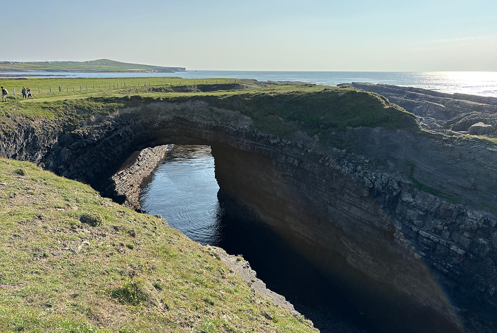
If I look back on our week-long trip, perhaps this day was the most beautiful. Breathtaking landscapes and natural formations accompanied our journey. Everywhere, it was visible how immense the power of nature is and, in contrast, how fragile we humans can be.
Our journey here is not yet over; we stayed in Ireland for the next few days and continued exploring County Clare.
June, 2025


