Adventures in Northern Ireland
- 15 hours ago
- 18 min read
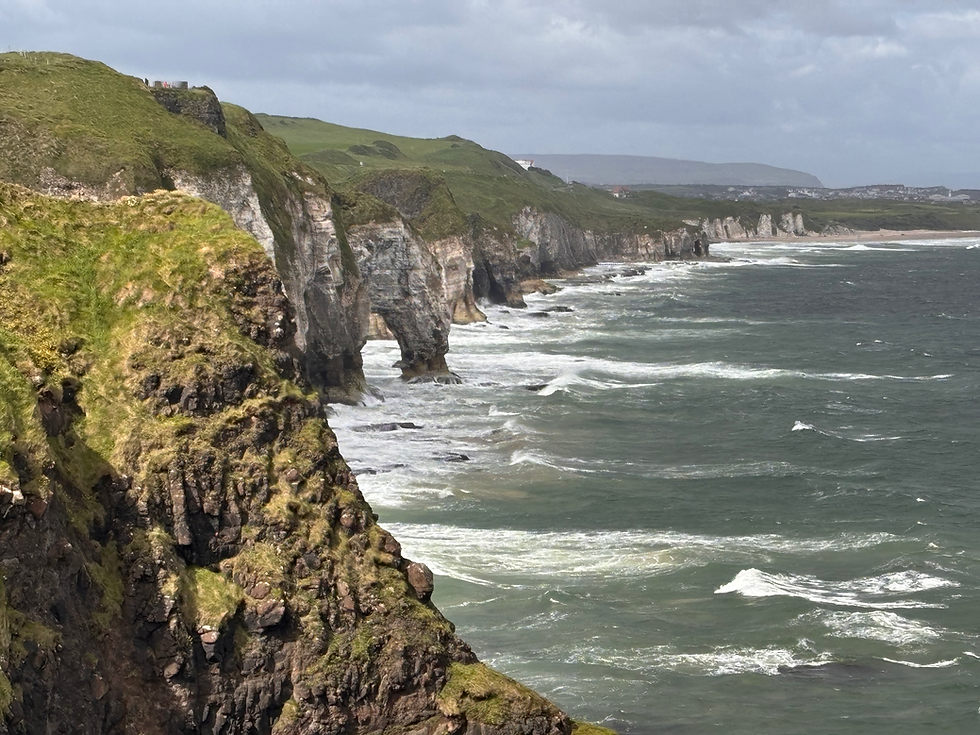
Three years ago, thanks to a concert, we were introduced to Belfast and Northern Ireland’s famous coastline. That visit was just enough to add the country to our “must-return” list.
The catalyst for our current trip was also a concert: LUSH Classical celebrated its 30th anniversary at Custom House Square in Belfast. Our journey was organized around this event.
Our plans were slightly altered because there are no longer direct flights from Budapest to Belfast, so we had to put together an itinerary along the Dublin-Portrush-Dublin route, arriving in Dublin on Thursday morning and departing from Dublin on Sunday evening (3 nights).


Day 1:
We spent our first day traveling from Dublin to Belfast. Our flight departed from Budapest early in the morning, and by around 10 a.m. we were already in our rental car. During the drive—which was expected to take 3 to 3.5 hours—we wanted to stop at three places: the Hill of Tara, Newgrange, and the Mourne Mountains.
This was the planned route: https://maps.app.goo.gl/2YVFhixk1GGwphbJ9
Hill of Tara: The Hill of Tara is an ancient burial and ceremonial site more than 5,000 years old, located in County Meath, in the Boyne Valley. At first glance, the site appears to be nothing more than a vast expanse of rolling green hills, but its surface hides countless points of interest.


There are about 20 ancient monuments in the area; one of the oldest is Dumha na nGiall (Mound of the Hostages), a passage tomb built around 3200 BCE that contains the remains of several hundred people. After the Neolithic period, burials continued into the Bronze Age, and the newer mounds primarily contained the remains of prominent individuals. Some of the monuments are surrounded by a 1-kilometer-long bank and ditch known as Rath na Rí (Fort of the Kings).

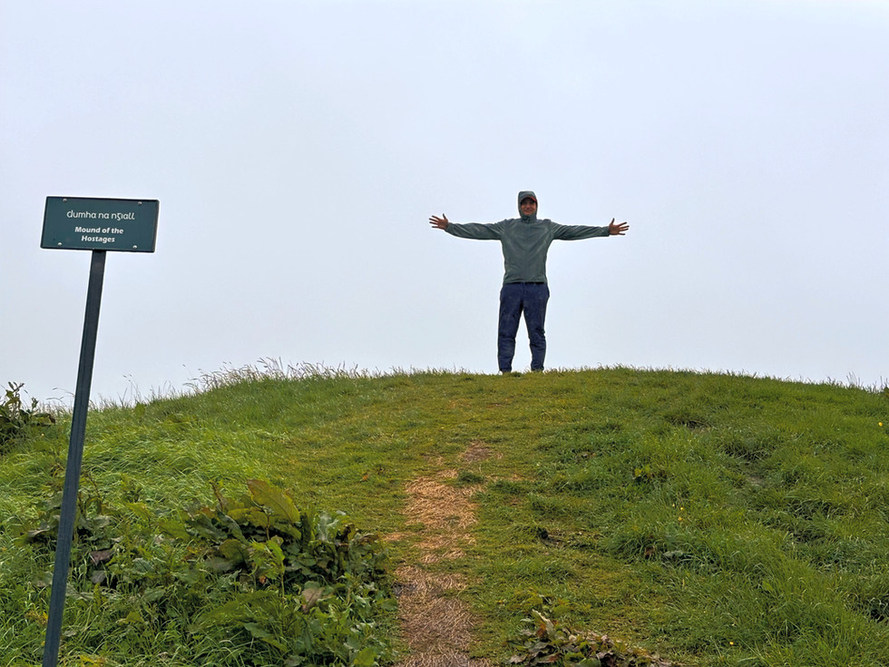
Tara became truly significant during the Iron Age and the early Christian period, and Mide became the royal capital of the fifth province of ancient Ireland.


Lia Fáil (the Stone of Destiny), a granite pillar sits among the mounds. It is approximately 1.57 meters tall. According to legend, the divine Tuatha Dé Danann brought it to Ireland, and it cries out when the rightful king of Ireland stands on it.


Tara served as the site of several significant events in later Irish history. In 1798, the United Irishmen’s army suffered a severe defeat here at the hands of British forces. About 400 Irish rebels were buried in a mass grave at the Forradh Monument, and the Lia Fáil was also moved here from its original location. The two stones on the hill commemorate the battle.
In 1843, O’Connell also chose Tara Hill as the site for his speech, where approximately 1 million people gathered to support the repeal of the Act of Union between Great Britain and Ireland.


We only spent half an hour among the mounds because of the pouring rain, but even despite the bad weather, we could still feel the spirit and mystery of the place.
After our walk, we stopped by the Maguires of Tara café in the small village next to the memorial site, and warmed up with a hearty English breakfast.


Our next stop is also located in the Boyne Valley: Newgrange is one of Ireland’s most important prehistoric sites. Unfortunately, we hadn’t thought to buy tickets in advance, so we had to wait about two hours for the next available guided tour, which took us only to the site. To enter the tomb, we would have had to buy tickets about a month in advance. We spent part of the two-hour wait exploring the Visitor Center, and the rest of the time we took a quick nap in the car.
Newgrange can only be accessed as part of an organized tour; the tour buses take about 20–25 minutes to travel between the Visitor Center and the site. The guided tour was disappointing - not in terms of content or quality, but in terms of its length. We had a total of 40 minutes to walk around this fantastic ancient monument. We could only stop and take pictures while rushing through


Newgrange, which is older than both Stonehenge and the Great Pyramids of Giza, was built by a prosperous Neolithic farming community. The kidney-shaped mound has a diameter of 85 meters and a height of 13 meters. It served as an ancient place of worship with astrological, spiritual, and religious significance. A 19-meter-long stone corridor leads to the inner chamber, which has three rooms. The entrance is positioned to align with the winter solstice, just like the passageway at the Hill of Tara. On the winter solstice, the rising sun fills the passageway with light. However, the probability of the sun actually shining on that day is as rare as winning the lottery jackpot.


The mound is surrounded by 97 kerbstones, most of which are richly carved. The most beautiful one is located at the entrance. The characteristic spiral pattern found on the stones also appears on the Irish euro coin issued in 2008.


Newgrange is part of a Neolithic archaeological site known collectively as Brú na Bóinne. The complex includes Knowth, the largest of the monuments, as well as Dowth, and 35 other smaller mounds scattered throughout the surrounding area. The site has been designated a UNESCO World Heritage Site.


Mourne Mountain- Silent Valley: The last stop on our first day took us to the Silent Valley Reservoir in the Mourne Mountains. Since we had spent more time at Newgrange than planned, we hesitated a bit about whether to stop here as well, and if so, where?


The valley has numerous hiking trails of varying lengths. The easiest is the approximately 3-kilometer circular hike - the Heritage Trail - marked with yellow signs, which starts at the parking lot and offers a taste of everything the area has to offer: meadows, ponds, mountains, and the famous reservoir.


The Silent Valley Reservoir was built to collect water from the Mourne Mountains, and it remains the main source of water for County Down and a significant portion of Belfast. The most interesting feature of the reservoir is the giant outflow, which looks as if a UFO had landed on the surface of the lake.


Another interesting attraction in the valley is the Mourne Wall, which was built to surround the river basin. The wall is about 1.5 meters high on average and stretches for 35 kilometers, passing through fifteen peaks of the Mourne Mountains.


After three stops, we arrived in Belfast in the evening. The next day promised to another busy one. We planned to explore the famous Coastal Causeway and, above all, visit the places we hadn’t been to before.


Day 2:
Every trip requires flexibility, especially when visiting a country with unpredictable weather. We got stuck in the rain several times on our first day, and it didn’t look like we’d see the sun for the rest of the week.
Prepared for such conditions, we left Belfast for our first stop, the Blackhead Lighthouse. This was the first point where our day didn’t go as planned. It may be possible to reach the lighthouse by car, but we weren’t able to. The navigation system kept directing us to the starting point of the Blackhead Path.This is a coastal walking trail that was built by the railway company in 1888 and has been in use ever since. The approximately 5-kilometer stretch is stunning and well worth walking. Unfortunately, we had plans starting at 10:00 a.m., so we didn’t have a chance to do it.
The Gobbins Cliff path: The Gobbins was dreamed up by a 19th-century engineer, Berkeley Deane Wise. He recognized how much the railway network could support the growing tourism industry along Antrim’s stunning coastline and make it accessible to larger numbers of people.


One hundred million years ago, the area around Gobbins was washed by a shallow, tropical sea with a flourishing ecosystem. The most common organisms were algae and single-celled organisms with calcium carbonate shells. Over countless generations of these shelled creatures, layers of calcium were deposited on the seafloor. The layers solidified, forming the limestone found along Ireland’s coastlines and in its caves. This rock forms the basis of the spectacular rock formations at the Gobbins.
Access to the Gobbins Cliff Path is only possible through an organized tour. We booked a slot for 10:00, weeks in advance. High-top hiking boots and a safety helmet are required for the hike. Both are provided on-site; the rental fee for the boots is 5 pounds, the helmets are free of charge. The tour guide greets the group with a brief introduction at the Visitor Center, from where minibuses take the groups to the tour site. After the introduction, it was clear that our tour guide had nothing more to say, but he was stalling, and for some reason we weren’t setting off. After about 20 minutes of waiting around, we were told that the tour was canceled because there had been a rockslide on the trail. We tried to find out exactly which section of the trail was affected by the rockslide and whether we could explore the other parts, but the technical decision had already been made by geologists in England based on the photos and videos they’d received. We were disappointed because we couldn’t reschedule our reservation for later days. There was nothing we could do: we returned the helmets, and some of the group began taking off their rented boots, while another group was just putting theirs on. After some confusion, we learned that the trail was safe after all, and we finally set off for Gobbins.


Construction of the path carved into the rock began in 1901, and the first section opened in 1902. The steel-beam bridges were built in Belfast, transported from there to Whitehead, and then carried on rafts to the site. Workers used a hoist to lift them into place from the top of the cliff.
The construction project lived up to expectations and was a tremendous success.


From the Visitor Center, groups are transported to the site by minibus—a trip that takes about 20-25 minutes.
The difficulty and danger levels of the trail are slightly exaggerated; neither the number nor the height of the steps is particularly challenging. The distance is 5 km; we follow the same route both there and back, and the hikes takes about 2,5-3 hours. The sight of the rugged cliffs, caves, and the wild ocean is enhanced by tangible signs of engineering ingenuity and expertise: the steel staircases and bridges.


The suspension bridge connecting the entrance to the Seven Sisters Cave opened in 1908, marking the trail’s final expansion. The Gobbins continued to welcome visitors for another thirty years, but it was closed during World War II. It reopened in 1950, only to close again in 1954 due to landslides and maintenance issues. Nearly 50 years later, the trail underwent a major renovation and has been welcoming visitors again since 2015.


The weather was unpredictable. We started our hike in gloomy, cloudy weather; halfway through, we were soaking wet, only to return to the bus in bright sunshine. Our group consisted mainly of senior people from all over the world: India, the Netherlands, Australia, and Poland. Our pace was a bit slower given their age, but at least I had plenty of time to take pictures.


After the Gobbins Cliff path, we continued along the coastal road, where our next stop was Madman's Window. This is actually a window-shaped rock formation created by glaciers during the Ice Age. It got its name because a sad man from a nearby village would come out to the cliffs every day, sit down, and wait for his beloved to return.


The scenery is beautiful and the Antrim Coastal Road is breathtaking.


Leaving the coast behind, we took the Torr Head Scenic Route and drove about 22 km through the mountains. I think - even though it wasn’t planned in advance - we made the right decision in picking this route. We were greeted by green meadows dotted with rocks that looked like white patches of snow, sheeps, and a fabulous panorama.


Torr Head: The word “torr” is of Celtic origin and means “large pile” or “mound.” This uniquely shaped headland is the point in Northern Ireland closest to Scotland. The Dún Bharraigh's castle, a figure from Irish legend, once stood on this 67-meter-high spot. In 1882, Lloyd’s of London erected a signal tower at the top of the hill, and the building next to the road leading to the tower served as quarters for coast guard personnel off duty. It is not locked, but the signalling tower is located on private property, and unfortunately, it is no longer possible to climb up there.
The legend of Deirdre, the Queen of Sorrows, is associated with Torr Head. Deirdre was the beautiful daughter of King Conchobar. At her birth, a druid prophesied that her extraordinary beauty would be both a blessing and a curse. When the king learned how beautiful his daughter would become, he decided she would be his wife. She was raised in isolation from the world in a forest, but in her youth she met one of the king’s warriors, and they fell in love. Fleeing the king’s anger, they escaped to Scotland; however, trusting the promise of Conchobar’s envoy, they returned, only to find that the warrior and his family had been killed.


After Torr Head, we drove to another high point,to Fairhead.


Fairhead is a massive dolerite cliff that rises 200 meters above the ocean. The cliff was formed about 60 million years ago, and for more than 300 years, the area has been owned by the McBride family, who raise livestock. At one time, coal were mined here, but only the family farm has weathered the storms of the centuries.


The private property has been opened to hikers and rock climbers - https://www.youtube.com/watch?v=25gFMR3G48c&t=31s with several trails marked out for them. Each one starts from the parking lot next to the farm. We were sure of the direction, but then we got stuck because the path led onto private property. Luckily, a couple happened to be passing by and showed us where we should have turned onto the hiking trail. Well, yes, we don’t often walk through grazing lands.

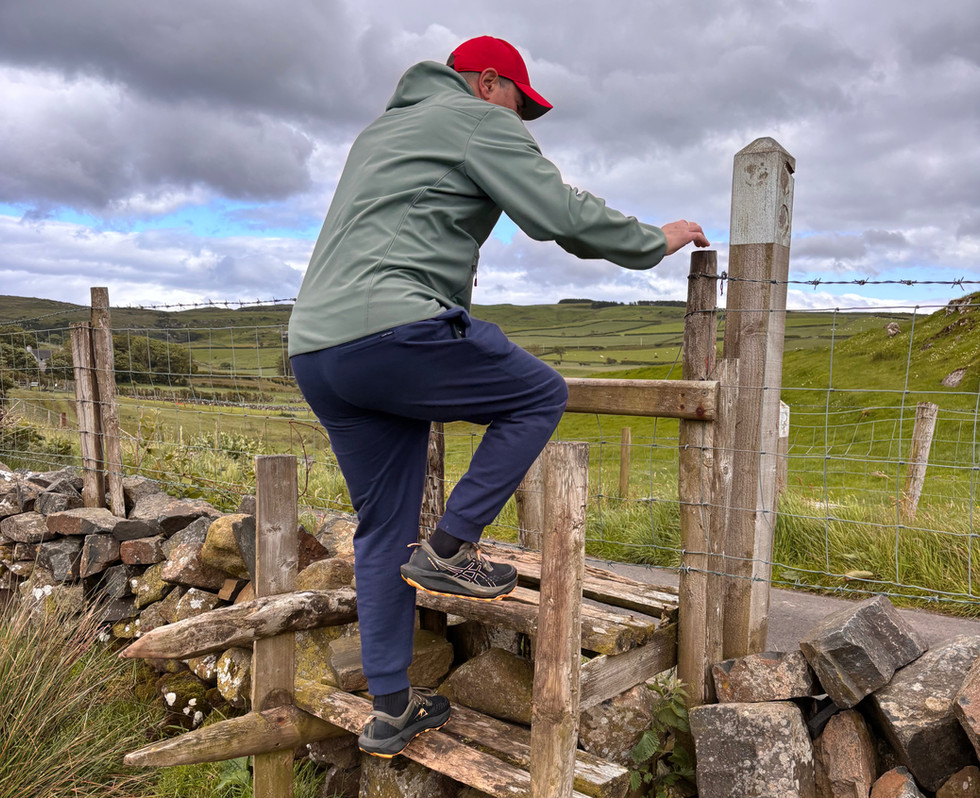
The weather changed almost every hour. It clouded over and we were cold even in sweaters, then the sun was shining brightly and we were warm even in T-shirts. One thing didn’t change: the stormy wind. Up here, where nothing stood in its way, it almost blew us away.


As we walked among the thick grass and the smaller and larger rocks randomly scattered about, we noticed a few young people on the edge of the cliff who, seeking shelter from the harsh weather behind a rock, had pitched their tent and were waiting for nature to quiet down.


Fairhead’s popularity grew after the “Game of Thrones” series. Like many other locations in Northern Ireland (see previous post on this topic: https://www.summester.com/post/belfast-az-oriasok-utja), Fairhead also appears in the series, in several scenes in Season 7. Instead of dragons, we were accompanied only by cows and sheeps.


After saying goodbye to Fairhead, we drove to Dunseverick Castle.
Perched on a basalt cliff and serving as a fortress, the castle stands on the site where a fort was first built in the 5th century. Throughout its history, it has been owned by several families, and it is said that St. Patrick baptized the future bishop of Ireland here. It was destroyed several times over the centuries, and today only a few of its walls remain as a testament to the past.


We’ve arrived at the final stop of our second day: the Giant’s Causeway (https://www.summester.com/post/belfast-az-oriasok-utja). We’d already noticed last summer that in Ireland (https://www.summester.com/blog/categories/irorszag), the sun sets significantly later than in our home country. Even though the distance between Belfast and our destination, Portrush, wasn’t very far, the many stops and, at times, the type of the roads slowed us down. Longer days are a big help when planning such packed itineraries. We arrived at the Giant’s Causeway around 7 p.m., where, fortunately, there are no set opening hours. :-) As I mentioned at the beginning of this post, we specifically selected sights for this trip that we hadn’t had time to see before . The only exception among these was the Giant’s Causeway, because it’s so special that we couldn’t leave it off our list this time either.


We arrived in Portrush late in the evening—our final stop. Here, for once, we didn’t stay in an apartment, but at the Golflinks Hotel. The spacious room and bathroom were a real treat, but what we appreciated most was not having to drag our luggage up a narrow staircase.


We’ve experienced many times that we always find common points with others, even with a complete stranger. While our dinner was being served, the waiter politely started a conversation with us, during which it turned out that he used to work in a circus, his best friend is a Hungarian acrobat, he’s familiar with the Hungarian National Circus, and, by the way, he still has some trained parrots that he likes to let fly on the beach.
Portrush, by the way, is a small seaside town with wonderful sandy beaches, a world-famous golf club - the Royal Portrush Golf Club - and a vibrant nightlife. Next to the hotel, on the site of what is now Kelly’s Barn, used to be Northern Ireland’s most famous nightclub, where even LUSH! had performed.


The beach, nightlife, and golf attract countless tourists to this region. Many people rent or buy mobile homes of various sizes as second homes. The caravan parks are well-maintained and have good infrastructure. For us, this type of vacation home is not yet common.


Our second day turned out to be another long one, full of experiences and one beautiful place after another. You can find the route here. We looked forward to the next morning, when—still on the coastal road—we had plans to visit more interesting places on our way to Belfast.


Day 3:
We left for Belfast around 9 a.m. Of course, we went down to the beach - Whiterocks Beach. The limestone cliffs towering above the shore, the sandy beach, and the rolling ocean created a stunning scene. There was hardly anyone on the beach; only one surfer had ventured into the water. Shortly afterward, we realized why these signs were posted on the road signs leading to the beach.


Two riders appeared; taking advantage of the empty stretch of beach, they galloped along and road their horses into the waves - with varying levels of success. One horse enjoyed the water, while the other wasn’t too keen on getting soaked in the foam. So much so that, while backing up, it fell on its bottom, along with its rider.


It was a great experience to watch the riders and, even from a distance, to feel the harmony between rider and horse and that sense of freedom. At Whiterocks, gentleness blends with wildness in a very special way, and sharp contours blend with blurred outlines. It was one of our most beautiful experiences over the past three days.


A short drive from the beach is a lookout point that’s worth stopping at. The limestone cliffs of Whiterocks, formed 145–65 million years ago, stretch all the way to Dunluce Castle. Over the centuries, caves and arches have formed in the limestone. Most of these can only be accessed from the sea, but the rocky coastline is also clearly visible from the lookout point above the cliffs.


If we look in the other direction, we can see Dunluce Castle in the distance, our next stop.


A few years ago, during our trip to Belfast, we spent a day exploring the Giant’s Causeway - including the famous coastal road and numerous filming locations from the “Game of Thrones” series - and arrived at Dunluce Castle just before dark, so we simply pulled over by the roadside to capture a few photos of it. Our tour guide said that, in his opinion, this is the most beautiful castle in Northern Ireland, even though it’s not in the best condition. Based on those memories, we didn’t have high expectations, but we definitely wanted to take a closer look at this ruined building. Meanwhile, the weather decided to show us what it means when sunshine provides the framework for the scenery. It couldn’t have chosen a better location than Dunluce Castle.


The castle sits atop a rocky headland, 30 meters above the ground, commanding a view of the surrounding landscape. It was built in the 13th century by Richard de Burgh, 2nd Earl of Ulster. It later passed into the hands and ownership of the McQuillan family, and then the MacDonnell family. The estate was passed down through generations; even Sir Winston Churchill - through his wife, Clementine Hozier - acquired a share in it. He later donated his share of the castle to the Northern Ireland government. Its turbulent history is steeped in legend. Dunluce’s first ghost was a woman dressed in white who stood on the cliff every day at sunset, gazing out at the sea. She vanished after one of the residents tried to speak to her. The story of Maeve Roe, Lord McQuillan’s daughter, is also legendary; she drowned along with her lover while trying to escape an arranged marriage. It is said that on stormy nights, her screams can still be heard. In the 17th century, during a massive storm, part of the kitchen collapsed and plunged into the sea, sweeping the staff away with it. The screams of the victims are said to still be heard on stormy nights.


This fairytale castle has inspired several artists. In the "Game of Thrones" series, it served as the Greyjoy family’s castle, and it is said to have also served as the inspiration for the castle featured in "The Chronicles of Narnia." Looking out from among the ruined walls, the rocky oceanfront unfolds before us in all its glory. The Wishing Arch is clearly visible from here as well. Next to the building, a footpath leads down to the shore, but unfortunately, it has been closed due to a rockslide. Yet the view from there must be spectacular!


After the castle, we headed to Carrick-a-Rede. Before that, we stopped at the famous Bushmills train station. The original Giant’s Causeway Tramway opened in 1883 and was considered the world’s first commercially operated, hydro-electricity system. It ran between Portrush and Bushmills, and the route was later extended to the Giant’s Causeway. The railway operated for 65 years before it was finally discontinued in 1949.


During our 4-day trip, we booked two activities in advance. One was the Gobbins Cliff Path, and the other was the Carrick-a-Rede suspension bridge. In the case of the Gobbins, the activity was nearly canceled due to a rockslide, but for the suspension bridge, our reservation was actually canceled. Carrick-a-Rede is a small island connected to the mainland by the hanging bridge that bears its name. The bridge sways over the ocean at a height of about 30 meters and spans 20 meters. Its predecessor was built by salmon fishermen about 400 years ago. The bridge can only be visited with an admission ticket. Since it is not a massive suspension bridge, there is a limit on how many people can cross to the island at one time. Therefore, it’s worth buying tickets in advance. A steep road leads down to the nearby parking lot; larger vehicles cannot access it.
From the parking lot, in the opposite direction of the bridge, there is a walking path, it’s worth taking a stroll along it as well.


It’s about a 15- to 20-minute walk to the bridge. If you want to take more photos or just stop and admire the scenery, it’s worth setting aside a good half hour for this. Since crossing the bridge leaves you highly exposed to the weather, it’s possible that the bridge might be closed. That’s exactly what happened to us. The wind was so strong that it was hard to even stand steadily on the coast. We made it to the bridge and were able to take photos through the locked gate, but we couldn’t cross. In such cases, the purchase price of the ticket is refunded.


We arrived in Belfast in the afternoon, where, after a bit of rest, we went to the LUSH! anniversary concert held at Custom House Square. In fact, our trip was organized around this event, and that’s exactly what turned out to be such a disappointment. While the fact that it gets dark late was an advantage for organizing outdoor events, here it is ruined the atmospher part of the concert. There were no projection screens, and the sound system was poor as well.


Day 4:
Dublin
On the fourth day of our trip, we had to head back to Dublin because our flight was leaving from there. We didn’t stop anywhere this time; we wanted to spend some time wandering around Dublin as well. We didn’t have any specific plans, and we didn’t have much time either. Fortunately, many of the city’s landmarks are within walking distance of one another.
St. Patrick’s Cathedral: Ireland’s largest church is more than 800 years old. From a canonical standpoint, Christ Church Cathedral takes precedence - for example, the consecration and enthronement of the Archbishop of Dublin took place there - while St. Patrick’s is regarded more as the national cathedral. The foundations of the current building were laid between 1191 and 1270.
According to legend, the expression “chancing your arm” (taking a risk) originated at St. Patrick’s Church: the 8th Earl of Kildare cut a hole in the door, stuck his arm through it, and sealed a peace agreement with the Earl of Ormond with a handshake.


Our next stop was Dublin Castle, which was built in the 13th century on the site of a Viking settlement. For centuries, it served as the seat of the English and later the British administration. In 1922, following Ireland’s independence, Dublin Castle became the property of the new Irish government.



As we continued on our way, more than 100 cars - each one more impressive than the last - were lined up on both sides of the road as part of a charity event. Our excitement grew even more when they started moving and we could hear the roar of their engines.



Grafton Street: Dublin’s most famous shopping street grew out of a small alley. Initially, it was lined with residential buildings, but after a period of decline, it became one of the most popular streets in the city. Thanks to the heavy tourist traffic, many buskers try their luck on this street. It’s said that Bono and Keywest have also performed here.


Temple Bar: The history of the Temple Bar district dates back to the Vikings, who set up camp in this area. It owes its name to Sir William Temple, a British diplomat who built a residence here. Today, Temple Bar is Dublin’s bustling cultural and entertainment centre, filled with bars, pubs, and cafés. The most famous of these pubs is the Temple Bar Pub.


While we're in the area, don't miss the Ha'penny Bridge. The bridge is Dublin’s oldest pedestrian bridge and one of its earliest cast-iron structures. It was built in 1816 under the name Wellington Bridge, but it’s better known by its nickname. It got this because of the half-penny toll that was collected from everyone who crossed the bridge until 1919.


Dublin is not only famous for its pubs and bars, but also for its many famous Irish musicians. The Wall of Fame in the Temple Bar district honors them.


Dublin was a real surprise for us, with its charming, lively streets. Even though we didn’t go out for beer, we enjoyed the numerous pubs and cafés and their atmosphere.We only had 4–4.5 hours for sightseeing because our flight back was leaving, and we still had to drop off the rental car beforehand. Just like the rental, the drop-off went smoothly.We spent four fantastic days in Northern Ireland and Ireland. The only thing that marred the perfection was Ryanair, which announced half an hour before departure that our flight would be delayed by nearly two hours. We got home around 2 a.m., tired but full of wonderful memories.I recommend Northern Ireland—and Dublin—to everyone. One benefit of climate change is that there are more and more sunny days, so if you’ve been hesitating because of the weather, there’s hope for a rain-free trip!
June, 2026


Comments