CANARY ISLANDS, GRAN CANARIA

The Canary Islands weren’t on our ‘where to go’ list, but thanks to a Christmas gift, we spent a few days in Gran Canaria in early March. We arrived on Tuesday morning and travelled back at midday on Saturday, so we had 3.5 days to explore the island.
The island of Gran Canaria (and the Canary Islands) belongs to Spain, although it lies just 150 km from Africa. Its shape is almost a perfect circle; to me, it resembled a round shell clinging to the rocks. It didn’t get its name from the canary bird, but from the large breed of dog that inhabited the island.
During our stay, we experienced the vagaries of Storm Emilia: it rained every day, accompanied by strong winds. On our daily excursions, temperatures ranged from 4 to 23°C; in fact, it even snowed in the mountains.
We explored the island by car; without one, getting around would be rather difficult and time-consuming. Many people rode motorbikes, and even more cycled, which, given the terrain, requires a superhuman effort in some places.
We hired the car through Ryanair from OK Mobility. An automatic gearbox is recommended; it’s much more comfortable to drive with one in the mountains.

Our accommodation was in Villa Nestor, in Ingenio, an authentic little village close to the airport. The owners are a Dutch couple who sold everything eight years ago and moved to Gran Canaria. They bought an old house, which they renovated over the course of a year, and opened their guesthouse with four rooms. The house and its interiors have retained the charm of the old building, whilst the roof terrace offers a magnificent panoramic view of the sea and the surrounding houses. The price of the accommodation included breakfast, which is prepared by the host himself, a former chef. It was divine and generous! Whilst enjoying these culinary delights, we had the opportunity to get to know our hosts and hear about their experiences in their new homeland.


Day 1: We spent the first half of the day arriving, picking up the car and settling into our accommodation. As we were close to the mountains, our first trip took us to the Barranco de Las Vacas (Tobas de Colores) canyon. We approached it via the GC-550 from the direction of Agüimes, but we couldn’t find it on our first attempt, because there is parking slot only for a few cars at the 14 km mark. The easiest and quickest way is to climb over the crash barrier at the bend and descend into a valley, where you have to go through a concrete tunnel running beneath the road to reach the entrance to the canyon.
If you enjoy hiking, you can also reach Tobes de Colores via a 19 km trail.


The canyon is about 50 metres long, and at first glance it doesn’t seem particularly interesting. But as we head further in, we realise why it’s often compared to the Grand Canyon.


Fortunately, there were few tourists, so we had plenty of opportunity to take photos and admire the unusual formations. The sun even came out a little, which brought out the colours and the play of shadows.
Our next – and final – stop of the day took us to the sand dunes of Maspalomas. Maspalomas is a real tourist hub on the southern side of the island, home to LGBTQ communities as well as Scandinavian, British and German pensioners. I didn’t like it; it felt a bit like Lake Balaton in the 1980s.
My mixed feelings were dispelled by the Maspalomas sand dune. It’s a protected area of around 400 hectares, where a desert-like atmosphere greets us.


Day 2: We began our second day in the La Fortaleza area. As always, whenever we get the chance, we stop along the way to take in the surrounding scenery. This time was no different.


The Tirajana Gorge was an area already known and inhabited by the indigenous people. La Fortaleza consists of three cliffs: La Fortaleza Grande, La Fortaleza Chica and the Titana. It is one of the few fortresses to have survived from the 1480s, and its purpose was to stop the European conquerors. It is said that the leader of the resistance threw himself from the top of the Grande in 1483, and the island’s inhabitants regard this date as marking the end of the conquests. Gran Canaria did not officially join the Spanish Crown until 1487. There is easy parking in front of the cliffs, and from here you can walk up to one of the largest caves.
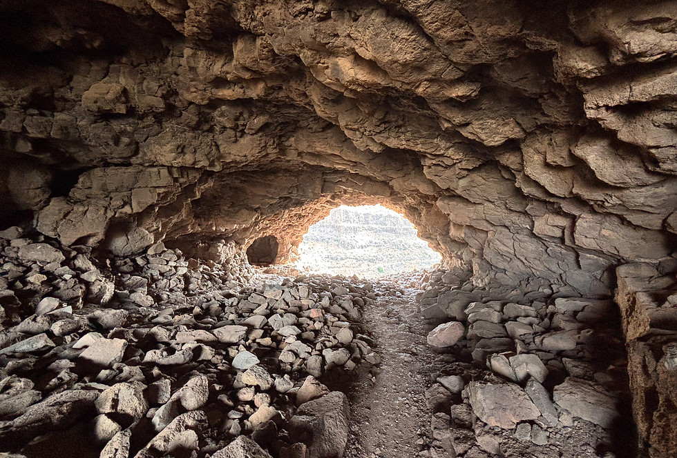
The cave is actually a tunnel; once you’ve passed through it, you can look down into the gorge from the other side of the rock and up towards the surrounding mountains.


After walking all the way round the hill, we made our way over to the other rock, where we found more small caves and hollows. At the end of the gently ascending footpath – which takes a couple of minutes to walk – we can see the surrounding landscape from a different perspective.


From the cliffs of La Fortaleza, we continued our journey towards Pico de las Nieves. The previous day – and, to tell the truth, on the days that followed as well – we didn’t have much luck trying the local cuisine. The breakfast we were served at our accommodation was so generous that we didn’t get hungry until early afternoon. Apart from one or two exceptions, everything was closed for the siesta and the restaurants didn’t open again until 8 pm. We usually got back to our accommodation before sunset and didn’t really feel like going out again afterwards, especially if it was pouring with rain.
One of the refreshing exceptions is the El Guata Bar (Grill) in the village of Santa Lucia de Tirajana. The large number of guests showed that the business model works and that there’s life here even during siesta. It’s also true that it’s situated alongside a busy route popular with motorcyclists, motorists and cyclists alike, and the lovely weather made us eager for a refreshing drink or some tasty snacks.

After our divine lunch – a tapas platter for two – we stopped at the Mirador Degollada de la Cruz Grande. As we were driving along the winding road, we spotted a waterfall, and thanks to the light traffic, we just managed to squeeze into the ‘car park’ – a space just big enough for one or two cars.

The waterfall starts from quite a height and can be a spectacular sight in wetter weather, but it wasn’t half bad even now.
The La Cruz Grande viewpoint: Erosion in the area has brought volcanic debris to the surface, creating flat plateaus, whilst a rich variety of flora and fauna has developed in the gorges. In the fertile, cultivated valleys, palm trees have survived in places, whilst on the higher peaks the Canary Island pine dominates the landscape. The area forms part of the Gran Canaria Biosphere Reserve.


Traditionally, the Pico de los Pozos de las Nieves is considered Gran Canaria’s highest peak – at 1,949 metres – although the neighbouring Morro de la Agujereada stands at 1,956 metres. However, this minor ‘discrepancy’ does not bother anyone. The peak’s name dates back to the 17th century, when snow was stored in huts built here. By the time we reached the summit, the temperature had dropped from a pleasant 18°C to 6°C, and in some places we could still see some of yesterday’s snowfall. The view would have been magnificent had the mist and clouds not shrouded everything. It was exactly the same as at the famous glass bridge in China – there, too, we couldn’t see a thing of the landscape. Here, too, we could only admire the tops of the pine trees.

As we made our way back down, the mist slowly cleared and the island’s distinctive geological formations became visible once more.


We tried to look on the bright side of the changeable weather: there were fewer hikers, the clouds lent a dramatic atmosphere to our photos, and we didn’t have to suffer in the blazing sunshine.
Our final stop of the day was Roque Bentayga / Cuevas del Rey near Tejeda. Roque Bentayga is a 141-metre-high rock formation. It is a sacred site on the island, the location of a sanctuary built by the indigenous people. The origin of its name is uncertain, but perhaps the most widely accepted version is that it means ‘a place that holds everything in place’. This version is consistent with the beliefs of the Guanche indigenous people, who thought that the rock was the Earth’s axis of rotation, the axis mundi.

More than 100 caves of varying sizes have been carved out of the cliffs; the largest of these is the Cueva del Guayre, the King’s Cave. Not all of them are accessible, and some have already been sealed off. Others have been furnished with a jumble of odds and ends, and animals may well have been kept in them.

By the end of our walk, the sun had emerged from behind the clouds once again.

Day 3: Our first trip took us to the Faro De Arinaga lighthouse on the south-eastern side of the island. The original tower was completed in 1897, with the light provided by a lamp room situated at the top of a stone tower. The third tower, which is currently in operation, is 14 metres high. Its lamp emits red and white light depending on the direction, and its power supply is provided by solar panels.

The neighbourhood is like something out of a fairy tale. The building next to the lighthouse – a restaurant, perhaps? – has seen better days; all its windows and entrances have been boarded up. Nor did the sight of two fighter jets flying overhead do much to lift our spirits, serving as a reminder of just how fragile this apparent tranquillity and peace really is.


From the lighthouse, it’s worth continuing your walk along the coast, where the rugged ocean and weather-beaten cliffs stand up to the fierce wind. The little cove is a real paradise for divers. In high season, the tiny, sandy beach is teeming with life; now, only the crabs hiding amongst the rocks and a few seagulls were basking in the sunshine.


Our next stop was Telde, with its 10 km stretch of basalt cliffs. A highlight of the promenade is El Bufadero, a natural hole formed amongst the cliffs. The ocean’s waves force water into the crevice, from where it shoots high into the air under the pressure.


El Garita is Telde’s most popular beach. The bay, shaped like a seashell, is covered in fine-grained black sand. A few people were sunbathing, and one or two had even ventured into the water. The sea temperature was probably around 18–19 °C.

As we’d spent less time at El Bufadero than we’d planned, we relied on Google Maps to find other places of interest nearby. That’s how we ended up at one of the most interesting spots of our stay on the island: the Cuatro Puertas caves. Most travel guides don’t even mention them!
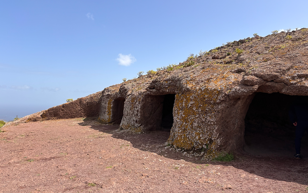

The caves (Cueva de los Pilares, Cueva de los Papeles, Cuatro Puertas) are nestled in Mount Bermeja, and the chambers within the complex served different purposes: some were used for offering sacrifices and holding ritual ceremonies; others were used as storage caves or sleeping quarters, whilst evidence of the manufacture of hand millstones and grindstones has also been found.


The succession of caves and the other side of the mountain also hold plenty of surprises and sights.


We thought we’d already passed the highlight of the day. But then came our final stop, the Caldera de Bandama, another truly special place.
The Bandama volcanic crater is the result of Gran Canaria’s most recent volcanic activity. Following a massive eruption, the volcano’s vent collapsed into the magma chamber, resulting in a huge, almost perfectly circular crater. Its diameter exceeds 1 km, its circumference is 3 km, and its depth is approximately 200 m.


A hiking trail approximately 3 km long runs along the ridge of the crater; apart from one or two minor inclines, it can be described as easy. The footpath starts just past the Golf Club and the Golf Hotel.


The longer and, at the same time, more difficult footpath also leads down into the crater. This is where the hermit Agustín Hernández Torres lived; together with his family and his 11 siblings, he looked after and cultivated the land within the crater. He died in 2021 at the age of 97, and a plaque commemorates him.
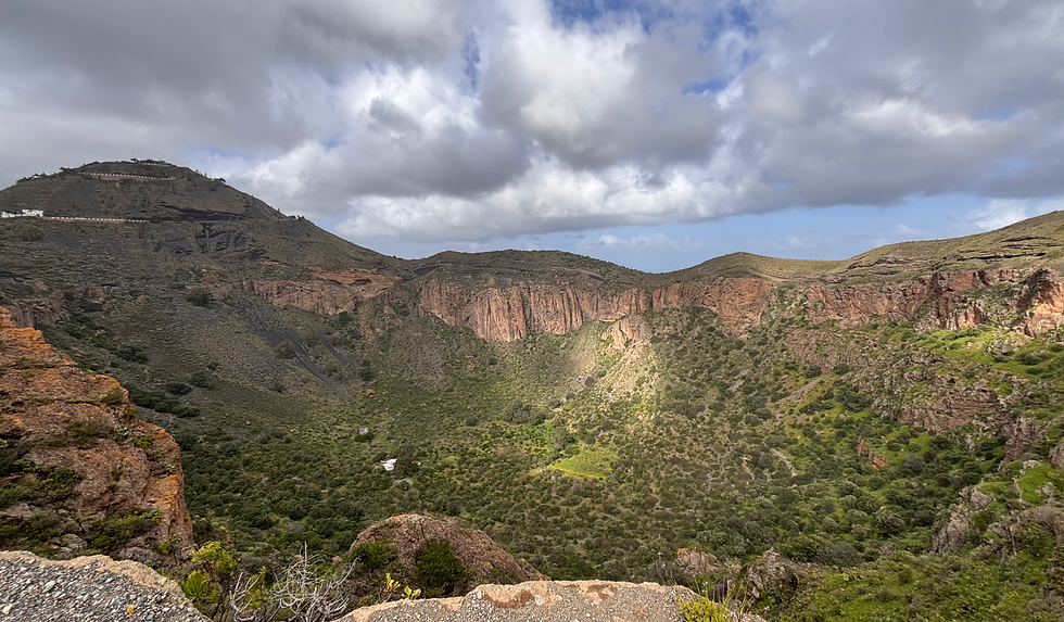

The highest point of the crater is 569 metres, the Pico de Bamdama. From here, weather conditions being favourable, there is a stunning panoramic view of the landscape and the surrounding villages.
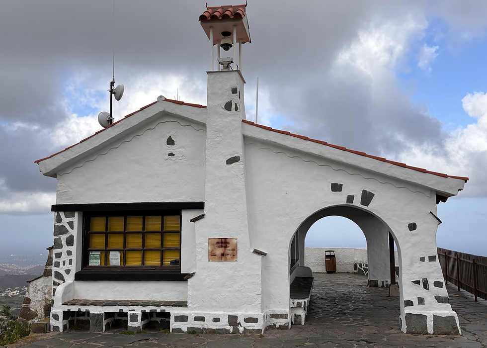

Day 4: We began our final (3.5th) day at another lighthouse, the Faro de Sardina or Punta Sardina, at the northern tip of the island, near the village of Gáldar. The original building was constructed in the 1890s and remained in operation until 1980. Its successor has been guiding maritime traffic since 1985. Thanks to its focal height of 47 metres, the light is visible from a distance of 20 nautical miles. Although the weather was sunny and warm, the wind blowing along the coast was so strong that it sometimes knocked you off balance.


From the lighthouse, we carried on towards the Mirador del Balcón. The landscape of the island changed as we made our way up the winding road. The shape of the mountains and the weather together reminded us of Hawaii.


The winding road offers few opportunities to stop, but Rouge Guayedra is one of the rare exceptions. Traces of stone houses dating back thousands of years, as well as evidence of burial and religious rituals, have been uncovered in the area.
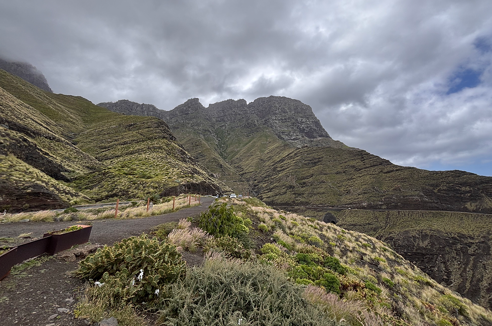

The Mirador del Balcón is one of the most spectacular sights on the island’s rugged western side. On the one hand, in good weather, if you look to the left, the peaks of the mountains stretching out in succession resemble a dragon’s tail. On the other hand, a cantilevered glass platform has been built onto the cliff, from which a full panoramic view of the landscape unfolds before you.


Unfortunately, we have to turn back from here – the road has been closed due to a rockslide. It’s still worth walking (about 10 minutes) all the way to the rockslide itself, as there’s a fantastic view of the ocean from there too.

Our next – and final – stop was the Tamadaba National Park. We’d wanted to go for a hike, but we hadn’t taken into account that we’d be winding our way through the mountains at a maximum speed of 40 km/h and wouldn’t reach our destination until late afternoon. Despite this, it turned out to be one of our most beautiful routes, winding through stunning peaks and valleys. We stopped at the Mirador del Molino viewpoint, where we could see the catchment basins and dams of the western region, as well as the spectacular silhouette of Roque Bentayga.


I mentioned earlier that this part of the island reminded us of Hawaii. But when we reached the top of the mountain, we suddenly felt as though we’d arrived in the Alps. A magnificent green meadow stretched out amongst the (snow-free) peaks. The only thing missing was the cows.


A few minutes later, the sun-drenched alpine meadow gave way to the misty, rainy Tamadaba National Park. The park is one of Gran Canaria’s most important protected areas and forms part of the UNESCO World Heritage Site. It covers an area of around 7,500 hectares and is home to one of the island’s best-preserved Canary Island pine forests. The nature reserve offers numerous walking trails for hikers and nature lovers. We were put off by the fog and rain, so we only walked about 1 km to a viewpoint. There, amidst the fast-moving clouds and fog, the sky occasionally cleared, allowing us to admire the surrounding panorama.
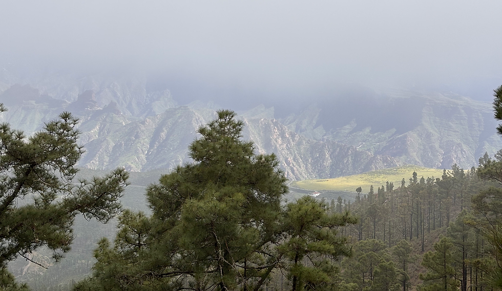

On our way to our accommodation, we stopped spontaneously by the roadside just past a village. After walking about 100–200 metres, we were greeted by one of the most beautiful views we’d seen along that stretch of road. Here, too, the sun was shining brilliantly, and, sitting in the lush green grass, we feasted our eyes on the beauty of nature.
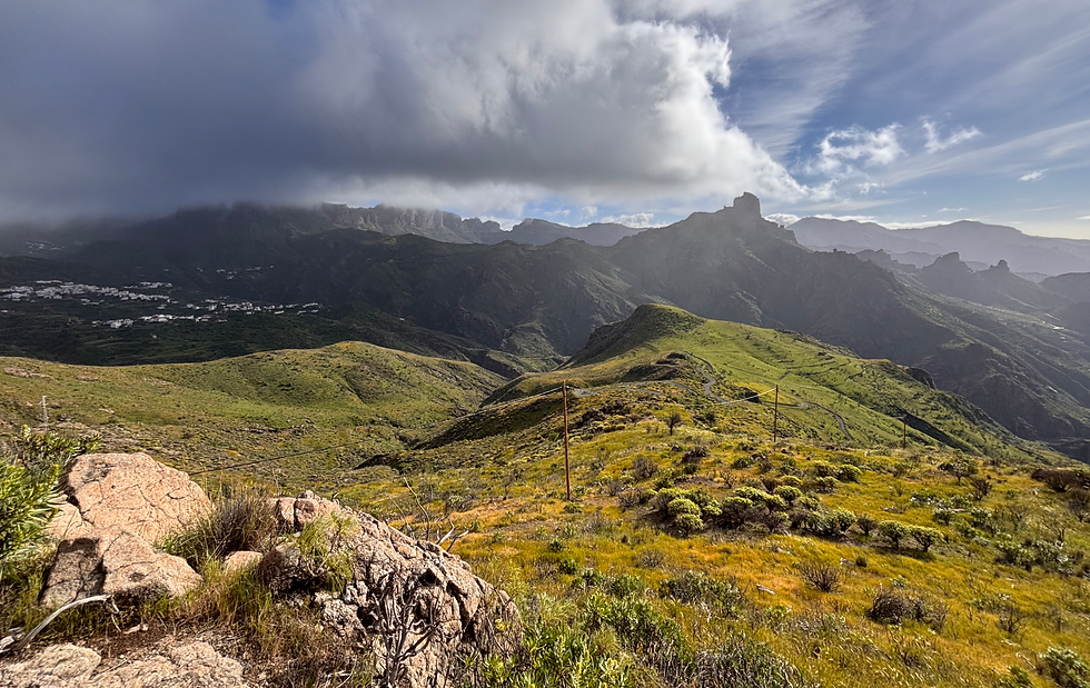

Our short four-day trip to Gran Canaria turned out to be just as varied as the weather. We focused mainly on the natural beauty and sights; due to time constraints, we had to miss out on a few interesting villages and some proper hiking. Despite this, we didn’t feel we’d missed out on anything and flew home full of wonderful memories.
March 2026


